Category Archives: California invasive plants

The Valley’s Wild West

😈 Hallowe’en 2021 Creepy Neighborhood Award: the Weird, Wicked West Valley

This year the Palsied Hand for creepiest, most terrifying 😱 LA Neighborhood goes to [eunuch strikes gong] 🤔🤭😏🙄🤞🏼🙋‍♀️🤷🏽‍♂️🙈

The old Rancho Las Virgenes, once owned by Miguel Leonis, see below. This trailhead, north of the Kobe site at the end of Las Virgenes Road, is a perfection of West Valley despair. Gorgeous but dangerously sick, protected but a firetrap. This is the core habitat of the rare Engelmann Oaks, which you see, are as exquisite dead as alive. I quickly recognized the mineralization patterns roasting the hills. (Drought schmout, it just rained.) But I only got two hundred yards down the trail when I was overwhelmed with putrid, pungent fumes of natural gas from the blowholes along the trail;— the unmistakable odor of driving up the Turnpike past Elizabeth, NJ. I took to my heels. More on poison gas later….😈

West San Fernando Valley! Go anywhere west of Van Nuys and you’ll find yourself in LA’s Transylvania. The mountains are creepy, the hills are gray like ghosts, the boulders make obscene mocking faces at you, there are gas fumes in the canyons, and the treacherous slopes hide a thousand Ways to Hell. Its bowls and washes cradle weird gated suburbs where ageless rich people seem to go in (Tesla, Tesla, Mercedes, Audi, Tesla…) but never come out. There are stoplights that are red in all directions and never change. Take this virtual tour of the SFV’s strangely sterile, outlandishly pricey, desperately macabre badlands…Timid Reader, you’ll cringe, gasp and retch at these scary, spookly stories! 😈 HA ha ha ha ha….

They Like Me! They REALLY like me!’ — The West Valley

LEONIS ADOBE: The snake-like road at the bottom of the map is the Ventura Freeway, aka “the 101,” which follows the route of El Camino Real, which is Ventura Blvd, upon which the Leonis Adobe fronts, and has done since 1844. The town of Calabasas was built around the ranch — location location location. It served in good times as a coaching rest stop. But sometime in the mid-1870s, a brutish Basque bully of a sheepherder named Miguel Leonis got control of Rancho El Escorpion by marrying Espiritu, the legitimate Chumash heiress. Leonis turned her ranch house on the Camino into a center of terror and intimidation for the whole West Valley. If arguments and fistfights and lawsuits didn’t settle it Don Miguel’s way, a gang of hitmen at midnight would. Murders and beatings just happened to people who crossed him. He stole, swindled, and connived; he drove off Yankee squatters with blazing shotguns. He acquired land and wealth and water rights simply, it seems, in order to dispossess other people. When he died, he dispossesed Espiritu; she had to wage a court battle for 20 years against the estate; they finally ruled it did belong to Mrs. Leonis, the by-then octagenarian Indian princess. She lived in her adobe home until she died in 1906, still looking great by the way.

Miguel Leonis, the Devil of Calabasas, died in September 1889, while driving a wagon home from a victorious session in court at downtown LA, and a celebratory booze-up afterwards. As his horse plodded across the silent, moonlit Cahuenga Pass (recently bought by the brand-new village of Hollywood), somehow the drunken miser fell from his buckboard and tumbled under the wheels, which left rut-marks across his face and chest. If such a thing could be an accident, it was natural justice, fittingly ‘Hollywood’ in tone and atmosphere. BUT, the ghosts are all in the West Valley. The adobe is famous as one of the most haunted places in LA. The house is a museum, where people come to see ’em — as they did this afternoon with kiddies in costume, etc.

Bonus creep: John Carradine was the last private resident of the adobe, sometime before 1962. His son Keith recalled him as an abusive alcoholic, and his mother as a dangerous schizophrenic; there were beatings, bars on windows, etc. The boys’ childhood must have been pretty harrowing.

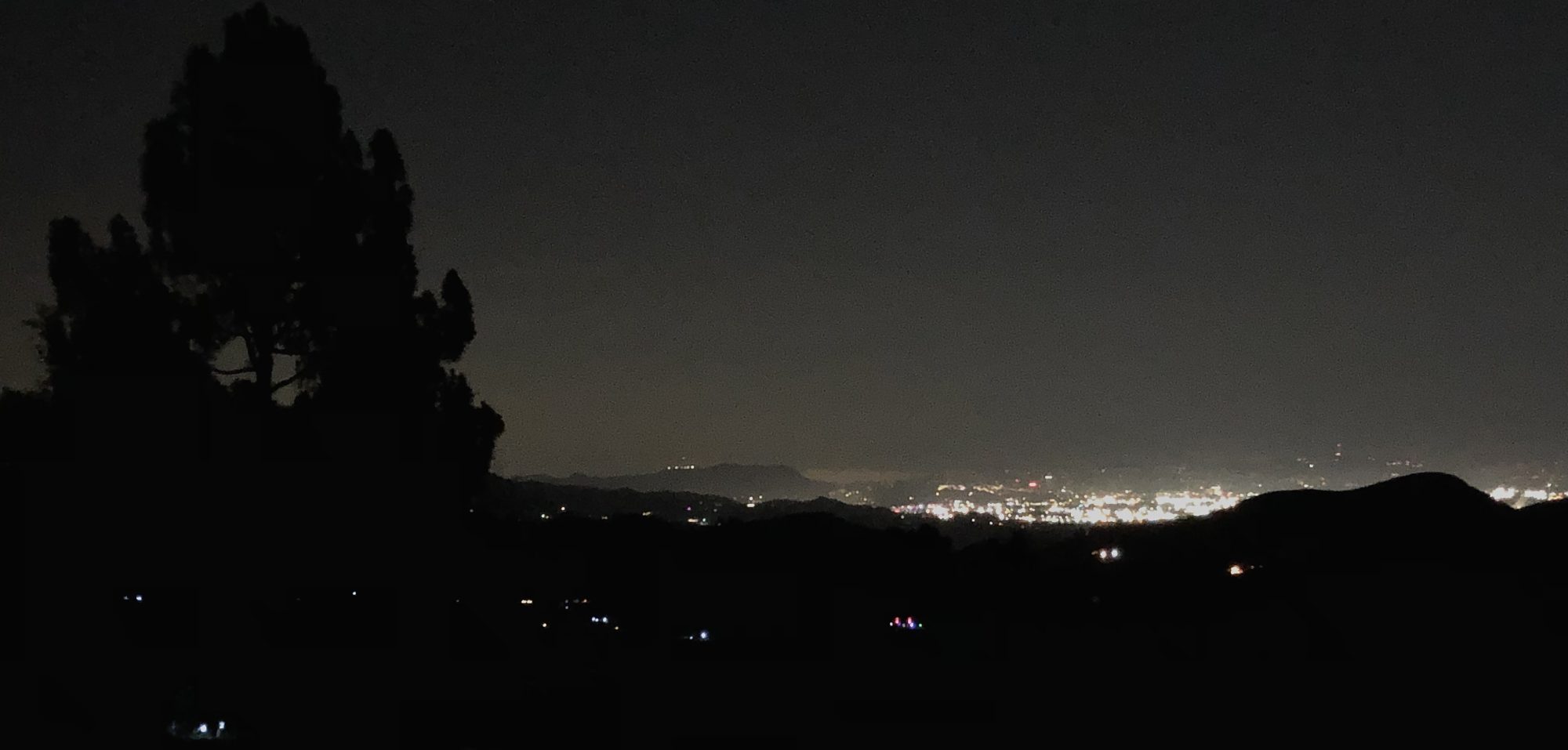
👹 KOBE’S DOOM — January 26, 2020, was a foggy, overcast day in the West Valley, not cheery and picturesque like the photo above. It seems the helicopter pilot became disoriented flying over the hills, tricked by the flat gloomy light. The accident shocked the world and sent basketball fans into mourning. The tragedy was compounded by an ugly legacy of accusations and lawsuits that have yet to run their course. This grim LA story just won’t go to its rest, trailing fetid fetters of money, fame, envy, and that most horrifying of all our dooms, human error. It may haunt us for a long time to come. RIP.

FOUNTAIN OF THE WORLD CULT BOMBING SITE

😈 Box Canyon Road is the road the heroine shouldn’t turn onto, in a Shirley Jackson novel. Meandering, narrow, hard to turn around on once inside, it is cut off from the rest of the Valley. This is one of those places that refugees from the new Atomic reality retreated to after the War… land so remote, so uncivilized, so sore to the eye, that nobody else had ever wanted to touch it before. Like many such marginal places in LA, it attracted its own cult; which, like many such cults, attracted its own disgruntled suicide bombers armed with twenty sticks of dynamite.💥 🔥

🛎🛎🛎👺 BONUS POINTS for the Standard Air disaster of 1949, noted in the red box above. The Fountain of Life folks helped rescue the survivors, God bless them all. This ghastly accident followed an eerily similar chain of events to Kobe’s demise; a pilot distracted by passengers, but not badly, flying in morning fog not too bad, descending through a familiar flight path too quickly, but not all that fast… The accident report is fascinating and depressing. It happened right at the Devil’s Slide, by Chatsworth Reservoir. For a chilling View of how the Valley fog can distort our hills for pilots, let lovely 🌋Lopez Canyon be our spokesmodel.👺 Land of Contrasts, indeed!

Top row, see the low hills in fog. Bottom, see the high hills hidden behind the low!

ROCKETDYNE SANTA SUSANA FIELD LABORATORY NUCLEAR REACTOR MELTDOWN SITE / WOOLSEY FIRE RADIOACTIVE FALLOUT 😈 Suck it up, SFV, the wages of sin is dust! 😮‍💨 Lucky that Valley Village is a few blocks out of range of the worst zone. The View has already uncovered the Cold War hubris involved in Rocketdyne’s 1952 sodium-nuclear reactor meltdown and cover-up. Now that we definitively know it’s as bad as we all thought it was, let’s cover it up again.🙈 🕵🏼‍♂️ What about the possibility that the Woolsey Fire was started in the first place by methane or other hydrothermal venting? 🙉

THE DEVIL’S SLIDE, PIONEER CEMETERY, CHATSWORTH PARK SOUTH, VITRIOL FALLS

🤡 Check back issues of the View for the infamous Devil’s Slide. The stagecoach road leads straight down to Oakwood/Pioneer Cemetery, then veers sharply around it at the bottom.

The humid green lawns seem especially eerie in these Latter Days of drought and sprawl. The 20th century fixation on turning the West Valley into the West Country of England, or Westchester West, with green lawn estates and clapboard churches, seems…a bit like folly, eh? 🤡 The tombstones here are great, creative, not somber. Angelenos, RIP.

😈 The gaping mouths of Vitriol Falls must be fresh in your mind from the recent post:

CHATSWORTH PARK SOUTH https://ssmpa.com/chatsworth-park-south-old.php This was the old RR Ranch, home to Roy, and Dale, and Trigger, pictured below. 😈 Part of it was developed as a skeet-shooting range in the 50s; afterwards the City figured to save it for a park, happily (for wildlife) contiguous to other West Valley parks. But in 2008 they found spent shell casings and lead contamination everywhere. They closed the park for YEARS; in 2013, the City renovation plan emerged, which was to tear out all the nature and turn the site into a giant parking lot for…itself. Finally they came up with something green, but without any imagination or uniqueness or sense of site ecology — just swing-sets and brown lawns and picnic tables — but anyway a few years ago it was re-opened. It was a terrible disgrace for the City of LA to take so long. It took dogged community activism to get that park back; the link above is to the website archive of the Santa Susana Mountains Association. It’s worth a Hallowe’en skim to remind yourself how much citizen work it takes to get the right thing done.

JUAN FLORES CAPTURED “Head ’em off at the Pass!” The Santa Susana Pass, fka Simi Pass, and the San Fernando Pass, and the Newhall Pass, fka Fremont Pass, were collectively “the Pass” — and they were all used by bandits and desperadoes as hideouts and get-aways back in the days when the SFV was the Wild West. One of the dreamiest most charismatic worst was revolutionary hero California rights activist murderer and robber Juan Flores. After he shot the sheriff, but did not shoot the deputy, a massive manhunt was coordinated by Rancho Ex-Mission San Fernando owner, U.S. Senator, and former Captain General of the California Lancers, Don Andres Pico. Flores was finally forced to surrender in the Pass. His hanging at Fort Hill, as reported by the Star, was so botched and gruesome it invites Hallowe’en perusal:

SPAHN MOVIE RANCH AND THE MANSON FAMILY CAVE

Roy Rogers wasn’t the only one whose Western-themed ranch hit hard times in the 60s. After the Hollywood studio heyday waned, Ed Spahn kept a movie location ranch going on some camera-ready acres in the Santa Susana Pass by booking it for TV Westerns like Gunsmoke and Bonanza. By the late 60s, even this second-wind was fading, and the ranch lacked business. So when Spahn met a nice fellow called Charles Manson who had been beating around the chaparral after leaving the Fountain of Life, Spahn hired him; and he let the youth’s groovy friends move in to do chores on the place, sleeping rough and running around barefoot and letting the sunshine in. 😈 Helter Skelter! On the new freeways, chic Laurel Canyon was just a few minutes away.

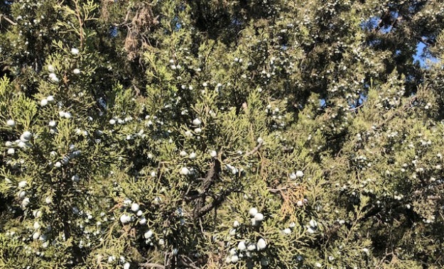
Natural gas — methane — can be smelled all over the West Valley but especially in Porter Ranch. (Natural gas is odorless; if you can detect it, it’s man-made. They put the sulfurous odors in so that it can be detected.) I’ve been driven off trails in Las Virgenes and elsewhere in the Wild West by the stench. It’s awful that the State has recently re-committed to pumping tons of methane into the West Valley storage grounds even after the scandalous Aliso Canyon leaks.

https://projects.laist.com/2019/after-aliso/ LAist.com has put together a good discussion of the problem. 😈 Because educated public discussion is always great at solving society’s problems! HA ha ha ha ha ha……

HAPPY HALLOWE’EN FROM THE VIEW!!😈💥🌋🔥👻🎃🧛🙈🙉🙊⚡️⚰️🦦

Sunday In The Park With Ores

I went to boring-old-Griffith Park partly because I haven’t been much lately, and I thought it would be full of People, and I imagined the thrill of going unmasked somewhere where life promenades gaily.

It was a relief, actually, to find it was rather sleepy. The glens were lush with hush and cloaked by cloud cover, making for high-resolution photographs, and reflective hiking.

Griffith Park epitomizes the potential for a SFV Nat’l Geo. Monument. The strapped City desperately needs federal assistance to install new exhibits; encourage respectful public access to sites of awe; put more rangers on-site to support public education and awareness of earthquakes, water, and chaparral ecology; and deepen America’s understanding and appreciation of the unique geology of our region.

I went hoping to see whether the the Santa Monica Mountains might be involved in the geologic drama currently gripping the other Valley ranges — rapid groundwater changes, newly active vent formations, etc. Once more I was staggered by what I found on the ground.
But before we go play in the dirt: Marinelayergloom + Sageinbloom = Aromatherapy.


MIKROKOSMOS, IN THREE PILES OF MUD

Nobody would look twice at any of these, nor would I have, before a few months ago. Even if you did — Just eroded sand piles, one would think; LA’s usual trashed public trails. Rubble beside a fire road. Fill dirt, bulldozed by a parking lot maintenance crew who left their job undone. Awful; burned hillside ruined by drought. Come away from there Bobby, there’s broken glass and syringes and snakes.

Understanding even the surface features of these things enough to see them, is taxing. Nobody has ever written a single word about them in Los Angeles, ever, I think. Perceiving them as essential organs of the Earth, that belong here, and that reveal the inner workings of the LA watershed, blows my mind to Cloudcuckooland. Astronomy, physics, geology and geography; hydrology, chemistry, organic chemistry, biology; paleontology, social history, economic history, industrial history; ecology, ethics, social policy. These mud piles will really kick your hyper-specialized 21st century human brain into shape.

EXAMPLE 1 — Of the three formations this is the subtlest. But it’s a whole ridge full of recent activity, which, together, illustrate the themes nicely.

These structures naturally form where there were volcanoes, those familiar molten rock-one-pipe-and-lava flow volcanoes that LA isn’t supposed to have had any of, but which racked the region during the Miocene, about 17 mya. Back then our fault block was migrating north, to collide with the mainland (at the Point of the Riviera, now San Gabriel Fault); subducting gouged-off sediments down into an accretion prism, including members of the famous Monterey Shale. For ages, trillions of microorganisms had been down in the shales and sediments feasting on the oozy organic goo in the layers. As the layers were folded, tilted, compressed, and broken open, first underwater, and then underground, hydrocarbons and sulfur gas gained the opportunity to release vertically to the low-pressure surface. Lava infusions (andesite? Alaskite?) roared up through weak joints in the infinite layers of shale.

Even millions of years after the infusions, the lava tubes and cracks and joints have been — are still being — infiltrated by breccia-conglomerate pipes saturated with mineral brine, under pressure and heaven-bent. Steam escapes into the first fresh air or wet sand it can find — often a creek bed, or at the crease of a road or trail cut. When the de-pressurized brine goes “pfft,” the heavy metals get jilted, emplaced on the rocks around the vents. All this, I’d barely grasped so far.

An old cauldron. The sumac in the center of the pipe, and the water it draws up, the microbes and mosses and lichens that eat some of the hydrocarbons in the water, and concentrate others, all play parts in making this geology happen. Right along with the quartzy-schisty sand of the diagonal layers, and the re-metamorphosed lava that long ago surged through those layers and formed the little synclines around the rim, like a king’s crown. Note the sumac essentially has a vase — a series of layered, lined, nested pots or chambers to hold harvestable water between them — until it boils with acid and burns the sumac. This cauldron was recently active, but not this year —you can see last year’s undisturbed leaves at the base (toasted, presumably, when Example #2 vented recently…see below).

Now a new wrinkle: some of these vents, millions of years after the host volcano has retired, and after the whole mountain has practically been eroded away, still create geo-chemical ovens that cook up the rare and valuable minerals — iron, copper, gold, silver, lead, zinc and many more. These structures are called porphyries; and they are the source of most of the copper mined today, and copper prices are soaring, and everybody in the world is looking for them in remote third-world spots, even on Mars; they plan, wherever they find them, to bribe the local dictator, strip-mine the copper with slave labor, ship it back to Earth, and get rich. Those porphyries. In Griffith Park!

Example 2 is stunning — an arch with points or rays like the diadem worn by the Statue of Liberty. (Damn you! You blew it up!) It has several cauldron areas and several vents. These have been recently active in mineralization, but still I could barely grasp how the alteration machinery works to change rock to sand, back into ore.

)

It seems to be dismantling old structures on the hillside with acid washes — carefully sorting out the rocks, vein by vein, and altering them as it washes the piles downhill…

The iron-oxidized vein of brown chert, and the sandy quartz of the sediment layers, and the Alaskite (granite) lava intrusions, have all the ingredients to make chalcophyrite, the primary copper ore. Presumably, although the porphyry is eroded away, these mingled piles or residue will still eventually sink together below the road, and get covered with other sands, until the next big rain or liquefaction earthquake. Then they might be re-washed, re-leached, re-doxed, and fuse together as a richer copper ore. The more times this happens, the more copper-rich the ore is made, secreted just below the water table (here, under the trail surface).

Porphyries were so-called by the Romans, for they found copper ore conveniently near their beds of lovely red and purple “porphyry” column marble. The name has stuck, though there is no porphyry marble in the Valley. (The chemistry doesn’t require red marble, just any limestone contact). Lime brings the carbon to a floating groundwater party that already has plenty of iron and sulfur. Heat and pressure can do the alchemy far below ground, but if certain salts and solutions are present, then all you need on the surface to get the reducing action going is for the groundwater table to rise. It could be ordinary rain, sinking through the cracks — ‘meteoric’ water circulation, leaching out metal salts. Or/and, it could be a tectonic compressive shift, like an earthquake on a thrust fault, that forces water and brine to mingle and rise, cracking rocks en route, cooking the salts, separating the dross, and adding or removing oxygen, iron, sulfur, carbon, hydrogen, etc to make metals. (The more modern term investors use is an Iron Oxide-Copper-Gold Deposit, or IOCG. But specifically copper is still called porphyry copper.)

Example 3 is from a parking lot so forlorn, so uninteresting, so damaged-looking, that even in Griffith Park, with THOUSANDS of acres and THOUSANDS of visitors and only THREE parking areas, and though it’s right on Zoo Drive, is always wide-open. This time, Patient Reader, you’re on your own as far as interpretation, as I am, since I’m the only resource for researching these things. A few notes: 1) the fancy colors are likely the copper minerals bornite, chrysocolla, azurite, and cuprite. 2) This hillside is likely to repeat porphyry pots all the way to the top. 3) The Hollister Fault is just over that ridge; 4) the Montgolfier balloon shapes are tipped to the left, or east; 5) and those oaks in those old cauldrons, were likely vertical when their acorns sprouted. Maybe you can tell me what’s going on!

So: while these vents are not magmatic eruptions, they are phreatic engines which happen in, around, and because of, an old volcano. Porphyries seem to be a manifestation of late-stage volcanism. They are common around the Pacific Rim where oceanic crust has been subducted, especially in convergent continental plate collision zones like the SFV. But seriously, you ain’t seen nothin’ yet. We’re going into the Hollywood Hills next, where the rich are getting richer every time it rains — though they don’t know it, and the fumes may kill them. Comedy is easy — geology is hard.


Plein Air — Tujunga Creek at Hansen Dam

We found a cheery amateur plein air landscape at the Studio City Council Thrift (framed in Santa Monica.) I thought I recognized the topography; the bluff, and the tree, and the green creek/woodlands, then the hazy hills beyond. It recalled a scene at Hansen Dam I had seen with Clio many years ago. I really needed fresh air yesterday, and I was curious to see whether the painting really matched my memory, so I went check the View.

In the event, my search proved more profitable than my goal. This is so often true in California that it should be an official footnote to our state motto: “Eureka!* *but my search was more profitable than my goal.” Here are some of the amazing Western Views and creatures I found while scrambling around the buff. Two different habitat types communicate here; it’s where foothill alluvial fan chaparral — the SFV’s signature habitat, one of the rarest in the world — meets Southern California riparian woodlands. The contrasts make for a bracing hike, or ride.

The verdict was the blue-tailed fly.

Oblong thickets are one of the most fun places to explore in the chaparral. There are usually several species of shrub grown together, back to back, like a Roman century’s square, often headlong to the prevailing flow of a long-vanished flood. Below, laurel sumac has got juniper’s back; …they protect the understory; here, cactus. As wind blows and water washes through the thicket, seeds get stuck in the tangle on the ground, and sprout there too, and the thicket evolves. I’ve learned they are a good place to spot unusual species. Here I was not disappointed; the north half of the thicket is a single huge California juniper covered with berries. Though supposedly not rare in our state, I had never seen one in all my born days. WOW. The bright blue berries were so cute I set them as my background image.

And now we’re at the edge of the creek, with the Fremont cottonwoods just beginning their shimmering fall color show:

L.A.’s Burnt-Over District — The Poor Sepulveda Basin

This wildlife refuge in the middle of the Valley has suffered several small fires since spring. Homeless jungles, bad management of that human problem, and bad land management practices in general, have prevailed for years, making fires infuriatingly inevitable. In all the past fires, big spots of the invasive Spanish pasture-mix grasslands had flash-burned; but the main wet cores of the refuge — Haskell Creek and the woodlands and wetlands around the pond, a major stop on the Pacific Flyway — was spared. Often it came at the cost of heroic, but dismayingly destructive, actions of the LAFD. What is at stake in these fires? The following pictures are taken over a bit more than year. Many rare species depend upon the spot. They are now displaced, in their high season. Better land management is desperately needed before it’s too late.

The vernal pool dries to a meadow, a prime milkweed-Monarch habitat in the Valley:
Down in there is the bed of Haskell Creek.
Resident osprey, vacationing pelicans.

A few weeks ago I went out to check the season’s accumulated damage. The only creature I could find in the meadow was dressed in burnt weeds just to blend in, sackcloth and ashes, and praying hard:


I was shocked by the lack of progress (to put it mildly) in reducing the fire threat. I took a few photos for the View, and resolved to find out more about what the real reason was for this constant failure. This was early August, just before the 116-degree heat wave:


Over the holiday weekend, when it was 116 degreees, fires raged here, again started by the cookfires of a jungle. On the Tuesday after Labor Day, while it was still sour with reek, I found this: