
This map (undated: 1910?) makes clear how the “Old Spanish Grants” in the San Fernando Valley got broken down into subdivisions. The names “Lankershim” and “MacLay” and “Porter” ignore the fact that the original Castillian grant, of lands (but not waters) to be controlled (but not owned) by the Mission, was on behalf of the Tongva and Tataviam people of the Valley. This map shows how the Californios skipped over the Indians, but asserted Mission land rights for themselves, only to sell them to various Yankees at bankruptcy prices.
N.B.: The land that became Valley Village lies between the deathly fingers of the pre-concretized Tujunga Wash, and the hungry snake of the pre-concretized Los Angeles River. The confluence explains why there was no development here, except for orchards, until 1949. This part of North Hollywood was just too flood-prone. until after construction of Hansen Dam.
(Valley Village, by the way, was the district that put the peaches in the City of Lankershim’s epithet, “Land of the Peach.” Before 1940, the orchards here were frequently inundated by Tujunga floods.)
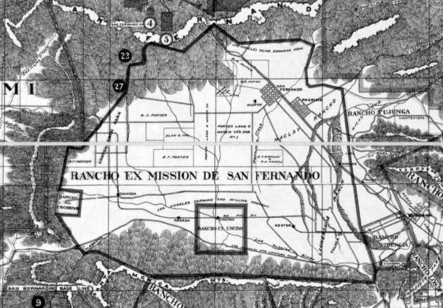
“An Early Map of the San Fernando Valley”
Leave a reply
